
Land navigation trainer for iPhone and Android
The land nav instructor in your pocket
GridReady teaches map and compass to Army doctrine, then puts you on the ground in a 3D simulator and grades your route the way an instructor would.
Wait list
Be first on the ground
GridReady opens in November 1, 2026. Leave your email and we'll tell you the day it's live.
The problem
Land nav gets failed on fundamentals
Real practice takes time, terrain, and daylight. Most people get very little of all three before the test that counts.
No lane to practice on
You cannot run a land nav course from a barracks room, a dorm, or a kitchen table. So the first real reps happen on test day.
Small errors, big misses
A wrong back azimuth, a skipped G-M conversion, a pace count that drifts on hills. Fitness does not fix any of these.
Slow, expensive lessons
In the woods you find out you were wrong an hour later and a kilometer off. Nobody tells you which decision caused it.
The simulator
Stand on the ground. Find yourself on the map.
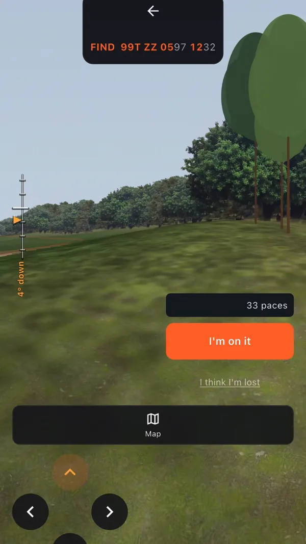
A first-person 3D view of Gridland, a training world built for land navigation, paired with its topographic map sheet. Look around, plot your location, plan a multi-leg route, then walk it while counting paces. Think of it as a land nav video game with an instructor built in.
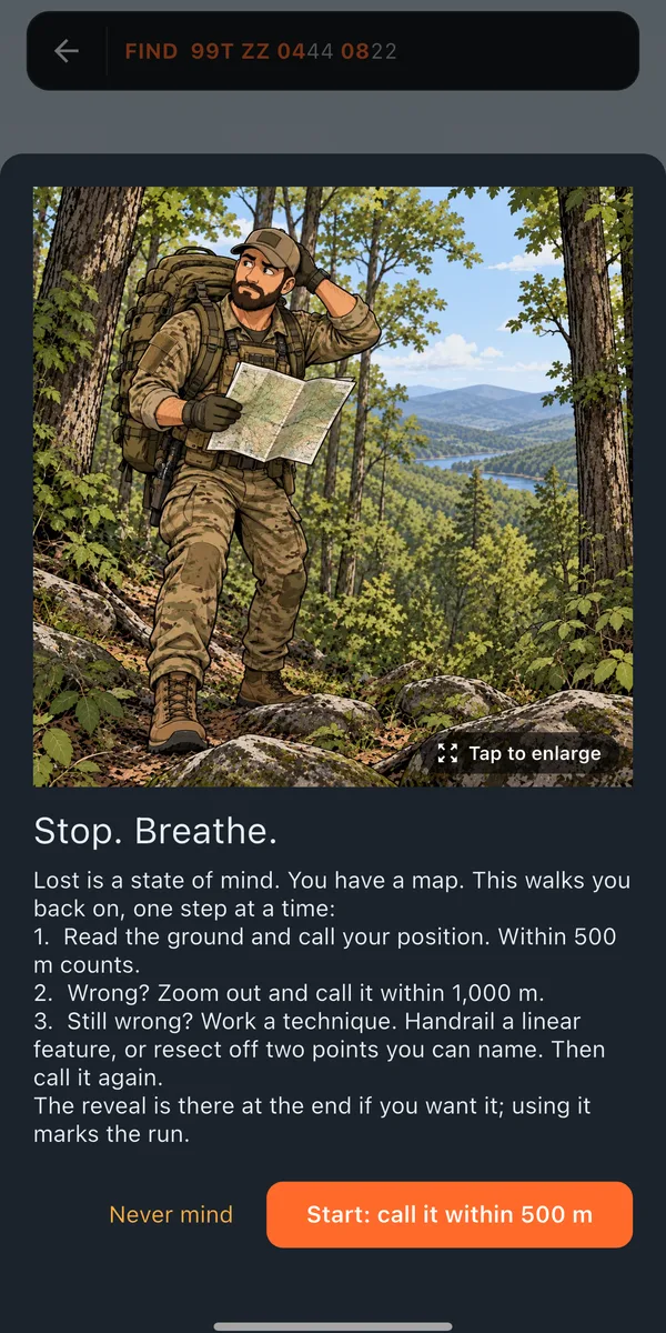
Tools include a protractor you place on the map, a compass, leg measurement, a pace-and-drift walk, and an "I think I'm lost" ladder that makes you call your position before it helps.
Field mode
Build your own land nav problem on real ground
Create a problem on a free map of a real area, plan every leg like an instructor would want it, then walk it outside with GPS.
- Pick your start point. Where you are standing, a tap on the map, or a typed grid.
- Box your area. A rectangle, a polygon, or a circle on the map.
- Set the course. How many legs, the shortest and longest leg, and night.
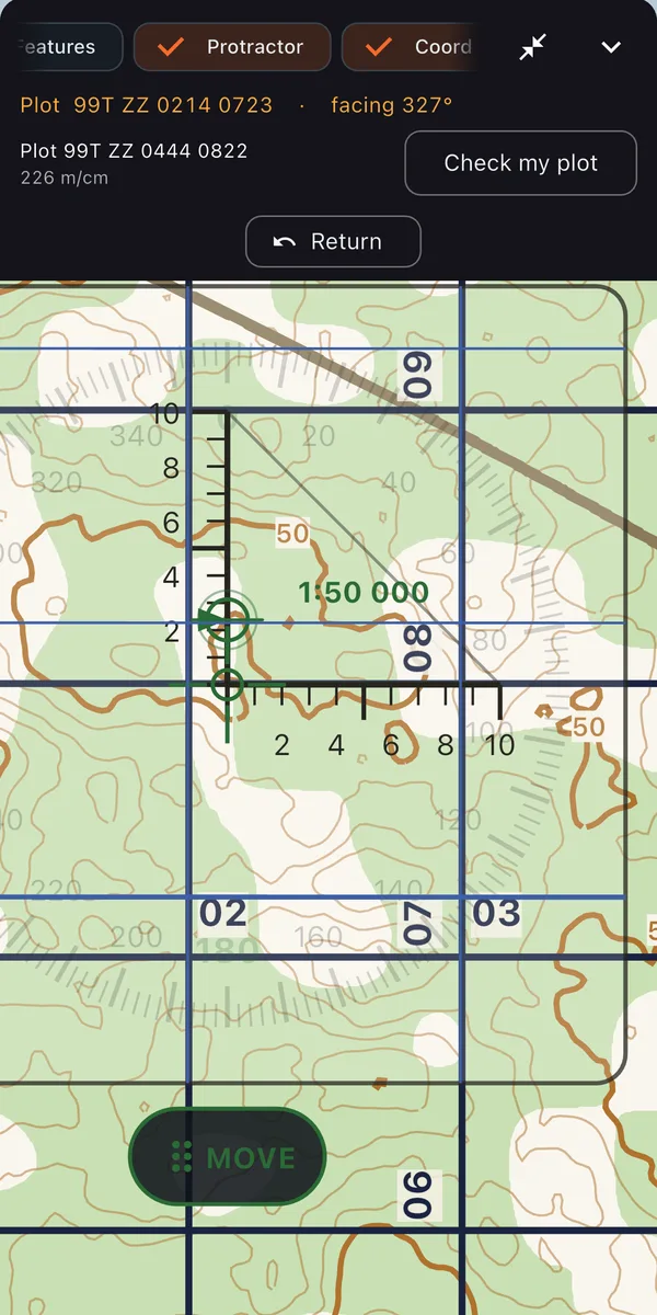
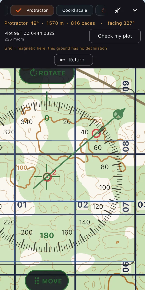
- Get your grids and plot them. Plot each objective with the protractor, then check your plot.
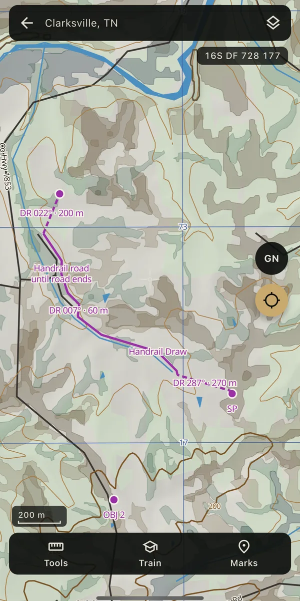
- Plan each leg on the map. Dead reckoning, handrails, terrain association, shooting an azimuth. Azimuth, distance, and paces come from what you draw.
- Get each leg scored. Attack point, backstop, checkpoints, re-attack point, and bail-out, each a pass or a fail with the reason.
- Walk it. Take the problem outside and walk it with GPS.
Field mode is included with a subscription. The maps are free.
What you get
Three things a field manual cannot do
Practice without the terrain
A 3D training world called Gridland on your phone, plus free topographic maps of real U.S. regions. Practice in bed, then go do it in person. Same map, same tools, same skills.
Plan it, then walk it
Create a problem on a real map, plan every leg, get your plan scored, then walk it with the GPS walk.
Graded like an instructor would
Route plans are checked for leg length against your measured drift, catching features, attack points, and backstops, with the reason in plain English.
Free maps
Real topographic maps, free for everyone
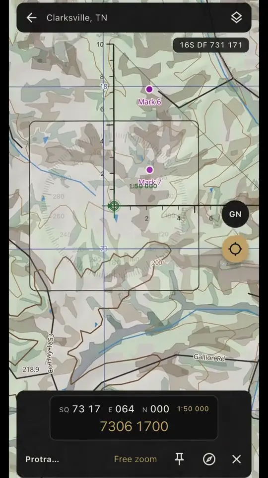
Topographic maps of real U.S. regions, built from U.S. Geological Survey data, with the MGRS grid. No subscription needed.
Place the protractor, drop and name marks, and read the grid coordinate, distance, and grid and magnetic azimuth between points. Downloaded regions work with no cell signal. GPS works offline.
What gets graded
A route is more than an azimuth
A good plan uses a handrail to carry you most of the way, an attack point you cannot miss, and a backstop that tells you when you have gone too far. GridReady checks for each of these and tells you which one is missing.
Leg length is judged against your own measured drift from the pace-and-drift walk, so the grade reflects how you actually walk.
Curriculum
Eleven modules, in teaching order
Taught to TC 3-25.26 Map Reading and Land Navigation, with FM 21-26 and GTA 5-2-12. Every lesson is illustrated, and the picture comes after the answer so it never gives it away.
- The mapMarginal information, the legend, scale, contour interval, declination diagram, and what the sheet tells you before you look at terrain.
- Contour linesHow lines on paper become ground under your boots.
- Terrain featuresThe features you will be asked to identify, and how to tell them apart.
- Grid coordinatesPlotting and reading points to 10 meters.
- DirectionTrue, grid, and magnetic north, and converting between them.
- The lensatic compassHolding it, reading it, and using it at night.
- Orienting the mapTurning the map so it matches the ground.
- DistanceKnowing how far you have gone without a GPS telling you.
- Route planningBuilding a route you can actually walk.
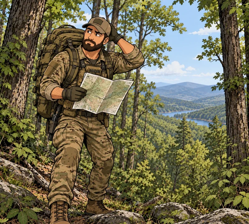
- Execution and recoveryWalking the route, and what to do when the ground stops matching the map.
- Night navigationNavigating after dark. Night pace count is its own calibration, separate from your day count.
Who it is for
Anyone with a land nav test, or a map to read
- Selection and school candidates. SFAS, Ranger selection and RIP, Special Operations selection in every branch, Air Assault, OCS and cadet land nav tests.
- Soldiers, cadets, Guard and Reserve. You have a test date and not much time or terrain.
- Hunters, hikers, search and rescue. Read a topographic map and use a compass properly.
In the field
Your phone becomes the map
- Free topographic maps of real U.S. areas with GPS. See where you are, even with no cell signal.
- Read your grid in MGRS, and the azimuth and distance between any two points.
- Plan a route in Field mode, then walk it with the GPS walk.
- Then put the phone away and run it again with a map and compass.
After every run
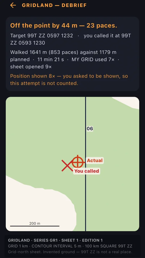
The debrief tells you how far off you were
Pricing
Two plans. Same app.
Cancel anytime. Canceling is as easy as signing up.
Billed every 3 months. Good for a selection or school date on the calendar.
- Everything in GridReady
- Cancel anytime
Billed once a year. Costs less than four quarters.
- Everything in GridReady
- Cancel anytime
Save about 20% by subscribing here. Create your account and subscribe here, then sign in to the app. Coming soon to the App Store and Google Play.
Articles
Land nav, explained
Free to read, useful with or without the app.
Lost During Land Nav? How to Find Your Position and Recover
What to do the moment the ground stops matching the map: stop, go back to your last known point, read the terrain, resect, and re-attack.
Route planning · October 12, 2026How to Plan a Land Nav Route That Gets You to the Point
Plan a land nav route with handrails, attack points, backstops, aiming off, and pace count, so a small error never costs you the point.
FAQ
Common questions
Does it replace a real map and compass?
It can get you there: the free maps show where you are with GPS, even with no cell signal. But phones die and GPS can be wrong, so carry a map and compass as a backup. And if your test is map and compass only, GridReady is how you train for it.
For the compass, protractor, and other gear I recommend, see Gear recommendations.
Does it use GPS?
Yes. On the free maps of real areas, GPS shows where you are, and the GPS walk tracks a route you planned in Field mode. GPS works offline. The simulator runs in Gridland, so it doesn't use your location.
The app uses your location on your phone only: to show your position, check pace, and record a walk. Your GPS location is never sent to us or anyone else. Marks, plans, drawn areas and tracks stay on your phone.
Is this official Army material?
No. GridReady is not endorsed by, affiliated with, or an official product of the U.S. Army or the Department of Defense. Army doctrine is cited as the source of the teaching, not as an endorsement.
How do I cancel?
Web purchase: sign in to your account page and choose Manage or cancel. App Store purchase: iPhone Settings, your name, Subscriptions, GridReady, Cancel. Google Play purchase: Play Store app, your profile icon, Payments and subscriptions, Subscriptions, GridReady, Cancel. Access runs to the end of the paid period.
Get your reps before the lane does
Subscribe on the web and unlock the app. Coming soon to the App Store and Google Play.